|
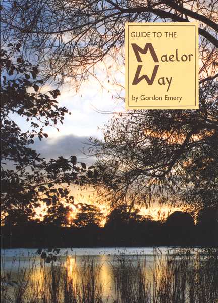
The Maelor Way is a 24 mile/38 kilometre waymarked cross-country trail using public footpaths, lanes and a canal towpath. This guide includes directions for walking both ways, with detailed maps, points of interest and illustrations by the author.
Price of book: £9.95
126 Pages
Published by Gordon Emery in 1991
ISBN: 9781872265988
|
The Maelor Way is a 24 mile/38 kilometre waymarked cross-country trail using public footpaths, lanes and a canal towpath.
At the eastern end it links with four waymarked routes at Grindley Brook, near Whitchurch. These are the Sandstone Trail, the South Cheshire Way, the Marches Way, the Sandstone Trail, and the Shropshire Way. The western end meets Offa's Dyke Path at Bronygarth, near Chirk. Near both ends, the Way also meets the Llangollen Canal.
Most of the Maelor Way is easy walking across pleasant meadows and through woodlands. Many parts of the walk follow waterways: Grindley Brook, the Llangollen Canal, and the rivers Dee and Ceirog. The Way also passes through three villages: Overton, with its ancient yew trees, one of the seven wonders of Wales; Penley where the Polish Hospital once boosted the population threefold; and Hanmer, situated on the mere which gave the village and its local aristocracy their name.
This guide includes directions for walking both ways, with detailed maps, points of interest and illustrations by the author.
Errata/Updates:
Errata & Update MAELOR WAY Feb 2012
Bus 146 runs to Overton, Penley, Hanmer, Bronington and Whitchurch from Wrexham. Travel enquiries: 01978 266166 or Wrexham.gov.uk/bus. Trains go from Wrexham to Chirk.
See foot of page for accommodation details.
p7 p12 p14
p16
p20
p21
p24
p25
p27
The Olympic Torch was carried along the Maelor Way in September 1991, from Overton to Gledrid, for the Barcelona Olympics in 1992. It was passed from the Mayor of Wrexham to the Mayor of Welshpool by the Scouts.
Teams of relay runners on the Maelor Way Inaugural Relay (6th April 91) completed the route in (first) 2 hrs 50 mins, (last) 4hrs 52 mins.
Definitive maps are now held at the Rights of Way Department, Transport Depot, Abbey Road South, Wrexham Industrial Estate. 01978 729762.
Diversion: Westwards: change last paragraph - ... mill leat and then turns left across the leat through a gate, turning right above Wolvesacre Mill [4]. In the second field turn right through the kissing gate then left and through another. Turn left up the lane.
Eastwards: replace first paragraph - At the foot of the hill turn right through the kissing gate and follow the bank of the old mill leat. Turn right, go through the next kissing gate then turn left through two fields above Wolvesacre Mill [4]. Take the gate on your left but continue in the same direction along the leat. Take the gate ahead and veer slightly left ... (read directions from 5th line)
‘itinery’ should be ‘itinerary’.
lines 7 & 21: bridlegate now replaced by field gate.
‘Henw’ should be ‘Henrwst’.
‘Burwardstone’ has more recently been attributed to ‘Iscoed’. ‘Middewich’ should be ‘Middlewich’.
The footpath at Whitewell church lies on a medieval track from Malpas.
p30/31 WARNING: Hedgerow in 3rd field from New Hall Lane (shown as split) now completely removed, you must now cross
the centre of this field.
p36 The 17th century building was a barn and is now a house, Maesllwyn Court, not Maesllwyn House as stated. Line 26: there are now only 2 stiles.
p37 stiles at Maesllwyn have been moved for a legal diversion.
p38 2nd para: omit ‘veer half-right’, read ‘go ahead’.
p39 new bridge erected to left (page upright) of that shown.
P56 westwardslast para Cross the bridge and turn right down the track. Cross six fields. At the farm track...
Eastwards para 1 Follow the concrete track to the stile on the right. Cross six fields. At the road turnleft....
p58/59 at Plas-yn-coed use new stile in farmyard fence instead of: westwards—first gate; eastwards—gate on right by farmyard.
p74 line 10: ‘Sodyllt’ should be ‘Soddylt’—one of various spellings for the area.
p76/77 There is a new stile and fence 2nd field opposite Pen y Bryn.
p80 ‘River Ceiriog’ should read ‘Morlas Brook’. DIVERSION goes other side of converted barn to stile 20 metres from road junction.
p83 line 24: ‘east’ should be ‘west’.
p87 Although Travers Morgan supplied the cross section of the viaduct, the final construction does not have a central strut: info supplied by a Clwyd CC Highways officer who walked through it.
p93 2nd to last line: omit ‘the river and 9 metres above’.
p97 rosebay willowherb is in evidence on the route but the illustration is great willowherb, Epilobium angustifolium.
p102 walk directions 2nd line: there are now 4 stiles before you turn up to the gate.
p118 South Cheshire Way is marked SCW near the waymark. The guide gives OS map numbers and meets the Mow Cop Trail at Mow Cop.
p122 Wrexham County Borough Council at Rights of Way Department, Transport Depot, Abbey Road South, Wrexham Industrial Estate now deals with footpaths: Tel. 01978 729762, email: rightsofway@wrexham.gov.uk. For Cheshire phone 01606 541802/3 or email prow@cheshire.gov.uk . For Shropshire phone 01743 255061.
p123 Tourist Information, Wrexham is now 01978 292015.
Accommodation. HIGHER WYCH: Mill House 01948 780362. HANMER: Horsemans Green Farm 01948 830480, The Dukes, 01948 830269. PENLEY: Bridge House 01978 710763. CHIRK: Hand Hotel 01691 773472, Glencoed 01691 778148. TREVOR: Borrow’s Rest 01978 822933. WESTON RHYN: Rhoswiel Lodge 01691 777609. BRONYGARTH: The Old School 01691 772546. For current details contact Tourist Information, 01978 292015 or visit www.wrexham.gov.uk. NB. Weston Rhyn and Bronygarth are in Shropshire—contact Tourist Information (Oswestry) 01691 662753.